

Ngari Prefecture Map: Administrative Center, Districts and Counties
Find Shiquanhe, Ngari’s administrative center, on this Ngari prefecture map, with seven counties, main towns and the Gunsa Airport connection.
Find Shiquanhe, Ngari’s administrative center, on this Ngari prefecture map, with seven counties, main towns and the Gunsa Airport connection.
Where is Lhasa? Use this Lhasa location map to find it in China and Tibet, see nearby Shigatse, Shannan, Nyingchi and Namtso, and learn how to get there.
Use this Chamdo city map to find Karuo District as the seat, see the 1 district + 10 counties, and learn why Bamda Airport is not downtown Chamdo.
Use this Nagqu city map to find Seni District, the 1 district + 10 counties on the Changtang, and why the Qinghai–Tibet Railway is the real gateway.
Use this Shannan city map to find Tsetang in Nedong District, understand the 1 district + 10 counties, and see why Gonggar Airport is not the city center.
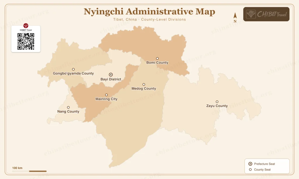
Use this Nyingchi city map to locate Bayi, Mainling Airport, Bomi and the region’s counties, with practical transfer and route guidance.
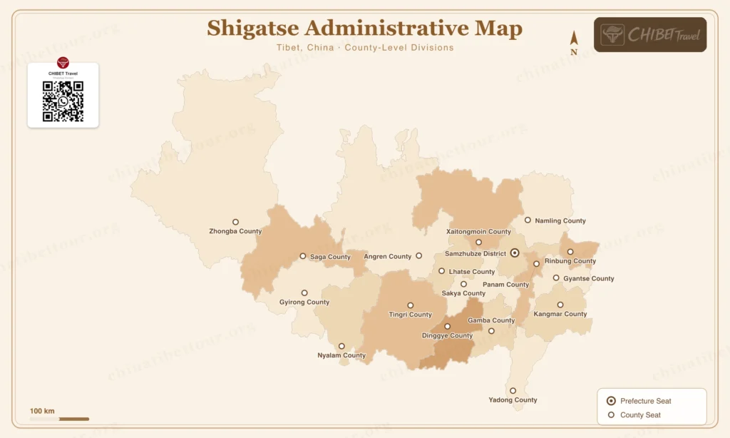
Use this Shigatse city map to distinguish the Sangzhuzi city center from the wider region covering Gyantse, Everest, Saga and border routes.
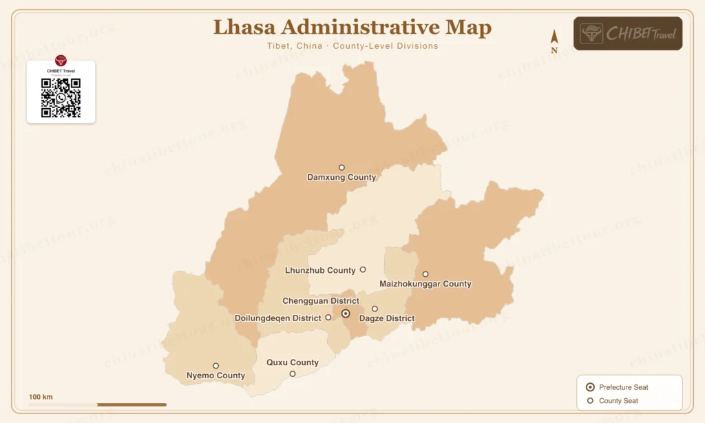
Use this Lhasa city map to find the city center, airport and railway transfers, Namtso road, and the main routes toward Nyingchi and Shigatse.
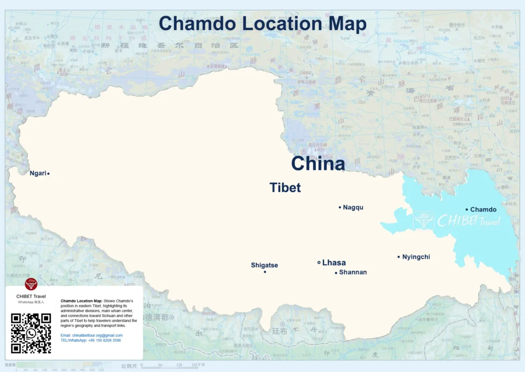
Explore Chamdo on a map: pair Ranwu Lake with Laigu Glacier, compare overnight bases, and plan routes from Lhasa toward Sichuan or Yunnan.
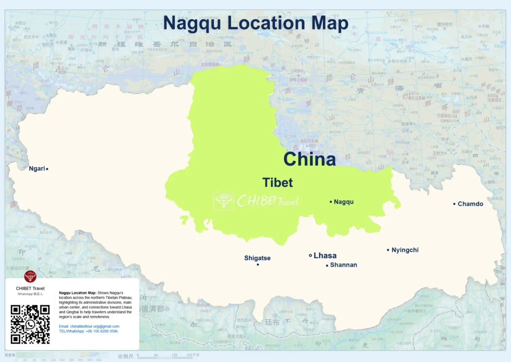
Read this Nagqu map to compare Namtso, northern grasslands and western lakes, with overnight bases, altitude and routes from Lhasa.