Tibet’s major mountains sit along the edges of the plateau, not in its middle: the Himalayas wall off the south, Mount Kailash rises alone in the west, the Nyenchen Tanglha Range backs the northern lakes, and Namcha Barwa anchors the forested east. This page maps all of them and answers three practical questions — where the mountains are, where an ordinary traveler can actually see them, and which routes combine them. One warning up front: a peak’s elevation, a viewpoint’s elevation, a pass’s elevation and your sleeping altitude are four different numbers.
Tibet Mountains Map: Quick Facts
Quick Tibet Mountains Map Facts
Tibet Mountains Map: Where the Major Mountain Ranges Are Located
Read the map by edges. Many first-time visitors picture Tibet as one solid wall of snow peaks, then discover that the high mountains frame the plateau instead of filling it — the center is high valleys, basins and open grassland. Each edge sits beside a different route. Four systems dominate: the Himalayas in the south, the Gangdise (Kailash Range) across the far west, the Nyenchen Tanglha in the north, and the eastern ranges around Nyingchi. We take them clockwise from the south.

Beyond these four, the Kunlun and Tanggula systems cross the far north, where the Qinghai-Tibet Railway crests Tanggula Pass at about 5,072 m (16,640 ft) — you meet those ranges through a train window rather than from a viewpoint; the China Railway booking service lists current services on that line. Our Tibet altitude map shows how high each system lifts the land. The full set of map pages lives in our Tibet map collection. For boundary and place-name checks, use the official standard map service published by China’s Ministry of Natural Resources.
Tibet’s Major Mountains and Peaks at a Glance
Seven peaks and ranges, each one sitting on or beside a road travelers actually drive. “Where travelers see it” means viewpoints and road corridors, not climbing routes.
| Mountain / Range | Elevation | Mountain system | Region | Where travelers see it |
|---|---|---|---|---|
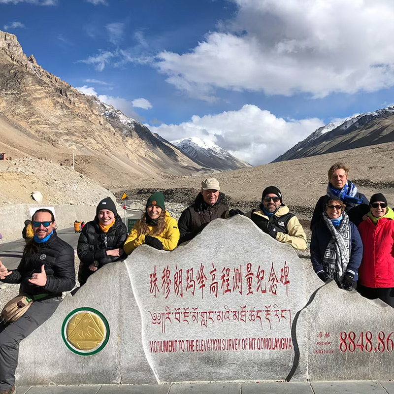
| Mount Everest (Qomolangma) | 8,848.86 m (world’s highest) | Himalayas | Shigatse, Tingri County | Gawu La, Rongbuk, Everest region |
| Mount Shishapangma | 8,027 m (world’s 14th highest) | Himalayas | Shigatse, Nyalam County | Highway corridor toward Tingri |
| Mount Cho Oyu | 8,188 m (world’s 6th highest) | Himalayas | Shigatse, Tingri County | Gawu La panorama, Tingri plains |
| Noijin Kangsang | 7,191 m | Himalayas | Lhoka–Shigatse border | Yamdrok–Gyantse road, Karo La |
| Mount Kailash | 6,638 m | Gangdise (Kailash Range) | Ngari | Darchen, Lake Manasarovar |
| Nyenchen Tanglha Range | main peak 7,162 m | Nyenchen Tanglha | Northern Tibet | Namtso road and lakeshore |
| Mount Namcha Barwa | 7,782 m | Eastern Himalayas | Nyingchi | Sejila Pass on the G318 |
Elevations checked October 2026. A summit elevation is not the elevation of the road or the place where you sleep; the planning section below explains the difference.
Southern Tibet: The Himalayas
The Himalayas form Tibet’s southern mountain wall, extending from the western Himalaya across Shigatse to the Yarlung Tsangpo Great Bend in the east. The name is Sanskrit for “abode of snow” — a fair description of a range that holds Everest, Cho Oyu and Shishapangma. For travelers the practical corridor is the Lhasa–Shigatse–Tingri highway toward Everest, which doubles as a viewpoint drive.
Four peaks on this page sit on or beside that one road; the map marks where each of them appears.

Mount Everest: The Main Event of Southern Tibet
Everest needs little introduction, but its Tibetan geography does. The summit sits on the China-Nepal border, and the north side belongs to Tingri County in Shigatse.
Travelers reach it entirely by road: the classic southern route runs from Lhasa through Yamdrok, Gyantse and Shigatse to Tingri, crossing Gyatso La at 5,248 m — the drive’s high point — before turning south over Gawu La at 5,198 m (17,054 ft), where as many as five 8,000-meter peaks line up on clear days. Below the pass, Rongbuk Monastery sits at about 4,980 m, with the north-side Base Camp a few kilometers on. The full route is in our Lhasa to Everest Base Camp map.
Mount Shishapangma: The 8,000er That Lies Wholly in Tibet
Shishapangma, 8,027 m (26,335 ft), is the only 8,000-meter peak lying wholly inside Tibet rather than on a border ridge. It rises in Nyalam County, and its broad white face shows from the highway corridor between Shigatse and Tingri — most itineraries collect it as a roadside sighting, without an extra day.
Mount Cho Oyu: A Giant Seen from the Road
Cho Oyu, 8,188 m (26,863 ft), stands about 28 km west of Everest on the China-Nepal border; its name is usually translated as “Turquoise Goddess.” From Gawu La and the plains around Old Tingri, its rounded, glacier-heavy profile stacks into the same panorama as Everest. For most travelers it is a bonus rather than a destination.
Noijin Kangsang: The First Big Peak on the Everest Road
Noijin Kangsang is often the first named high peak travelers meet on the classic Lhasa–Yamdrok–Gyantse drive, and many never learn its name until the driver points it out. The summit, 7,191 m (23,593 ft), rises beside the road south of Yamdrok Lake, and the Karola Glacier pours down its flank almost to the highway at Karo La. In one afternoon this leg delivers a lake, a glacier and a named 7,000-meter peak.
Western Tibet: The Gangdise Mountains
Behind the Himalayan chain, the Gangdise Mountains — also called the Kailash Range, part of the Transhimalaya — run the length of the Ngari highlands in the far west, with the G219 climbing in from the southeast through Saga. This is where Mount Kailash stands at 6,638 m (21,778 ft): not among Tibet’s highest summits, but a mountain of exceptional religious significance.

Mount Kailash: The Sacred Peak of Western Tibet
Kailash is the mountain people cross the plateau for. It rises alone out of the Gangdise Range near Lake Manasarovar, roughly 1,200 km from Lhasa, and is sacred in Hinduism, Buddhism, Jainism and Bon. No ascent has ever been recorded, and climbing is not pursued out of respect for its status.
What draws pilgrims is the 52 km kora around the mountain, crossed at Dolma La at about 5,630 m. Travelers watch the peak from Darchen at the kora’s trailhead, from the trail itself, and from the Manasarovar shore — the pairing of sacred mountain and lake that anchors our Tibet lakes map.
Northern Tibet: The Nyenchen Tanglha Range
The Nyenchen Tanglha Range rises northwest of Lhasa and stretches across central Tibet toward Nagqu, its highest peaks clustered around Damxung and the Namtso area; the main summit is commonly listed at about 7,162 m (23,497 ft).
It divides the river valleys around Lhasa from the lake basins of the north, and gives the Namtso road its whole backdrop. The road reaches its foot within a day of leaving Lhasa, which makes this one of the most accessible major ranges in Tibet.

Nyenchen Tanglha: The Range Behind Namtso
This one is a range rather than a single summit. Its crest rises above the lake’s southern shore, and the lake road from Lhasa crosses Nagen La at about 5,190 m; from the top, the range lines up along that shore like a wall — the signature mountain-and-lake landscape of the north. One caution: when a guide or an app says “Nyenchen Tanglha,” check whether it means the range or the main peak, since some apps pin a railway station of the same name on the line to Nagqu.
Eastern Tibet: Nyingchi and the Eastern Himalayas
At the Great Bend, the Himalayas swing east around Namcha Barwa, and the landscape flips from dry plateau to steep, forested valleys. Namcha Barwa itself, 7,782 m (25,531 ft), is the signature peak of the Nyingchi highlands, with the Yarlung Tsangpo wrapping around its base. East of the bend the high ranges continue toward Bomi and Chamdo as the Hengduan Mountains.

Mount Namcha Barwa: The Cloud-Draped Peak of the East
Namcha Barwa behaves differently from every peak above: it stands at the eastern end of the Himalayas, so you look up at it from green valleys rather than across a high, dry pass. The classic viewpoint is Sejila Pass on the G318, at about 4,728 m, where the summit appears over a panorama of ridgelines on clear mornings — and only on clear mornings, because locals joke that the mountain is shy and cloud hides it even in settled weather. Autumn and winter mornings give the best odds.
Tibet Mountains by Route: How Many Mountains Can You See?
A peak list becomes useful when it is sorted by road. The map collects the main mountain-viewing legs of the classic itineraries; the summaries below run in order of trip length, and each pairing connects to a CHIBET itinerary you can actually book.

Noijin Kangsang and Everest: The Classic Lhasa–Everest Route (6–8 Days)
The classic first itinerary runs Lhasa → Yamdrok → Gyantse → Shigatse → Everest Base Camp and back, roughly 700 km from Lhasa to Everest on the southern line. In one drive you collect Noijin Kangsang above Yamdrok, the Karola Glacier at Karo La, Gyatso La at 5,248 m and the Gawu La panorama with Everest at its center. Six to eight days gives it room for acclimatization; our Lhasa Everest Base Camp tour follows this shape.
Everest and Nyenchen Tanglha: Adding Namtso (8–10 Days)
Add Namtso after Everest and the trip becomes a survey of two different Tibets: the Himalayan wall in the south, then the lake-and-range landscapes of the north with the Tanglha snowline behind the water. Eight to ten days covers it at a sane pace, which is how our Lhasa Everest Namtso tour is built.
Everest and Kailash: The Long Drive West (10–13 Days)
Continue west from Everest on the G219 and the Himalayas fall behind as the Gangdise Range takes over, with Lake Manasarovar and Kailash as the destination. The two belong to different systems, and seeing both in one trip is the clearest way to understand that Tibet’s high peaks come in generations, not one range.
Our Lhasa EBC Kailash Mansarovar tour runs this line; Ngari sits higher and drier than the Everest corridor, and its short season makes an early-autumn window the sweet spot.
Everest, Kailash, Guge and Namtso: The Full Crossing (13–15+ Days)
The long version adds the Zanda valley and the Guge Kingdom Ruins to the west line, then swings back across the northern plateau past Siling Co to Namtso — Himalayas, Gangdise, western canyons and the northern ranges in sequence over fifteen days. Our Lhasa EBC Kailash Guge Namtso tour is built on exactly this arc, and it is a second- or third-trip route.
Namcha Barwa: The Eastern Corridor from Nyingchi to Bomi and Ranwu (4–6 Days)
The corridor from Nyingchi toward Bomi and Ranwu runs through lower, greener mountains that stay close to the road: forested ridges, hanging glaciers and the milky blue of Ranwu Lake under mid-range summits. Namcha Barwa is the best-known name here, but the region’s character is valleys rather than summits, and four to six days covers it comfortably.
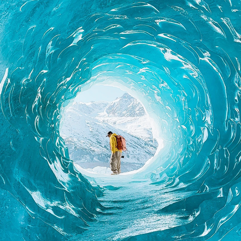
The corridor also has a winter signature: our 8-day Tibet winter blue-ice tour runs Nyingchi, Lulang, Ranwu, Bomi and the Laigu Glacier in the coldest weeks, when Namcha Barwa’s morning odds are at their best.
Namcha Barwa, Everest and Nyenchen Tanglha: The Grand Circuit (10–13 Days)
This longer circuit links eastern Tibet with the Everest region and the north: Lhasa to Nyingchi’s green valleys, Sejila Pass for Namcha Barwa, then Shigatse for the Himalayas and up to Namtso — three different mountain worlds in one journey.
Plan ten to thirteen days; some versions enter Tibet overland from Chengdu on the G318, the corridor our Sichuan to Tibet overland G318 tour follows, and in winter the same circuit runs as our 12-day Tibet winter blue-ice tour.
Four Mountain Systems, One Plateau
If you remember one line from this page, make it this: Everest shows you the Himalayas in the south, Kailash the Gangdise in the west, Namtso the Tanglha Range across the north, and Namcha Barwa the Eastern Himalayas around Nyingchi. Any itinerary covering two or more crosses the full spread of Tibet’s mountains — and the day-by-day versions live on our Tibet travel route map.
How to Choose a Tibet Mountain Route by Trip Length
Match your days to the mountains rather than the other way around. The bands below condense the routes above into five time frames — no “best” band, only the one that fits your calendar.
| Trip length | Mountain focus | What you cover |
|---|---|---|
| 4–5 days | Lhasa, Yamdrok and nearby Himalayan landscapes | Yamdrok and the surrounding peaks; no Everest, no Namtso |
| 6–8 days | The classic Himalayan line | Lhasa–Yamdrok–Shigatse–Everest, with Everest as the main objective |
| 8–10 days | Himalayas plus the northern range | Everest plus Namtso: two contrasting mountain landscapes |
| 10–13 days | Himalayas to western Tibet | Everest plus Kailash, with much longer driving distances |
| 13–15+ days | South, west and north in one crossing | Everest, Kailash, Guge and Namtso: the fuller mountain geography |
Two cautions. Days in Tibet are not interchangeable: every extra hundred kilometers of plateau road costs more than the map suggests, and acclimatization, not driving, sets the pace. And no band guarantees a clear summit.
When Are Mountain Views Clearest?
Peak visibility is a weather question, and it follows patterns reliable enough to plan around: mornings beat afternoons, and autumn often brings the clearest air.
What Blocks the View, and the Morning Rule
Three things hide mountains in Tibet: cloud building from late morning as the sun heats the slopes, summer monsoon moisture against the southern and eastern ranges, and jet-level winds blowing Everest’s snow plume across the summit. The counter-rule is simple — go early. Morning is the most reliable window, and it matters most at Everest and Namcha Barwa, where cloud and wind can rewrite the view within hours.
Seasonal Mountain Views
| Season | Typical viewing conditions | Road and access | Trade-offs |
|---|---|---|---|
| Spring (Mar–May) | Improving through the season; crisp mornings | High passes dry out; western routes get going around May | Early spring can hold winter cloud |
| Summer (Jun–Aug) | More cloud and rain around the southern and eastern ranges | Landscapes at their greenest; visibility less consistent | Everest and Namcha Barwa less predictable |
| Autumn (Sep–Nov) | Often clearer and more stable over the main Himalayan viewpoints | A popular season; book ahead | Colder nights at high stops |
| Winter (Dec–Feb) | Often very clear on suitable days | Cold; some high roads reduced or weather-dependent | Fewer services, real cold |
Autumn often combines clearer views with stable road conditions, but visibility and access are separate questions: a clear winter morning can coincide with a snow-affected pass road, and a scenic area can pause operations in any season. Confirm conditions for your travel dates. Checked October 2026.
How to Plan a Tibet Mountain Trip
The map gives you the mountains; the four rules below keep the itinerary realistic.
Choose the Mountain You Most Want to See
Start with one honest target and let its location shape the route: Everest points to the southern line through Shigatse, Kailash to the long G219 west, Namcha Barwa to Nyingchi, and the Nyenchen Tanglha Range to the Namtso road. A trip built around one mountain you care about beats one built around four distant ones you only half-reach.
Check the Route, Not Just the Map Distance
On a flat map, Everest looks close to Lhasa; on the road network it is a two-day drive with passes and checkpoints in between. Plateau driving is slow by design, so read every pairing of peaks as a driving question first — distance, driving time, overnight stops and altitude changes — which is what our Tibet road map is for.
Understand Peak Elevation versus Travel Elevation
Every mountain itinerary runs on four different numbers, and mixing them up is the most common planning mistake. Summit elevation is the mountain’s own height — Everest at 8,848.86 m. Pass elevation is the highest point you drive across — Gyatso La at 5,248 m. Viewpoint elevation is where you stand to look. Sleeping altitude is where your body spends the night, and it is the number to watch most closely: many itineraries drop back from the Base Camp area to Tingri at around 4,300 m so you sleep lower. Our Tibet altitude map lists these figures for every stop on the main routes.
Check Current Access Conditions
Mountain travel in Tibet runs on permits and road conditions that shift with policy and season. Foreign travelers need a Tibet Travel Permit from a licensed operator, plus additional documents and clearances for border areas.
Rules can change at short notice: since August 28, 2026, the National Immigration Administration has suspended electronic border-area permits for Shigatse City following the August 26, 2026 debris flow at the Gyirong crossing. Confirm the current status before booking — we keep the live version in our Tibet permit map.
Frequently Asked Questions
Tibet Mountains Map FAQ
Where are the Himalayas in Tibet?
Along the entire southern edge of the region. The range runs through Shigatse past Everest, Cho Oyu and Shishapangma, and ends at the Yarlung Tsangpo Great Bend in Nyingchi, where Namcha Barwa marks its eastern anchor. Nearly every southern route runs beside or toward it.
Is Mount Everest in Tibet?
Yes, half of it. The summit sits on the China-Nepal border, and the north face and north-side Base Camp belong to Tingri County in Shigatse. Travelers reach the Tibetan side entirely by road via Yamdrok, Gyantse, Shigatse and Tingri, with no trekking required.
What are the major mountains in Tibet?
Seven names cover almost every itinerary: Everest, Kailash, Namcha Barwa, Shishapangma, Cho Oyu, Noijin Kangsang and the Nyenchen Tanglha Range — the Himalayas in the south, the Gangdise in the west, the Eastern Himalayas in Nyingchi and the northern lake-and-range landscapes. The table earlier in this article lists all seven.
Can you see Mount Everest without climbing it?
Yes — that is what most visitors do. Gawu La at 5,198 m lines up as many as five 8,000-meter-class peaks on clear days, Rongbuk Monastery sits below it, and the north-side Base Camp area is reached by road and shuttle, without a multi-day trek. Mornings give the cleanest light.
Where is Mount Kailash on the Tibet map?
In the far west, in Ngari Prefecture (a name-level location; the official maps govern every boundary detail). It stands in the Gangdise Range between Lake Manasarovar and Rakshas Tal, with Darchen at its foot — roughly 1,200 km and several driving days from Lhasa via Shigatse and Saga, which is why Kailash itineraries need far more time than an Everest-only route.
Where can you see Namcha Barwa?
Mainly from Sejila Pass on the G318 near Nyingchi, plus roadside viewpoints along the same highway. Autumn mornings give the best odds, because the mountain is famously cloud-wrapped even in settled weather.
What mountains can you see around Namtso?
The Nyenchen Tanglha Range, whose snowline rises above the lake’s southern shore. The drive from Lhasa crosses Nagen La at about 5,190 m, where the range and the lake come into view together — the signature landscape of northern Tibet.
What is the difference between a mountain’s elevation and a viewpoint’s elevation?
Four numbers matter: summit (Everest at 8,848.86 m), pass (Gyatso La at 5,248 m), viewpoint (Gawu La at 5,198 m) and sleeping altitude (Tingri, around 4,300 m). Plan around the last three.
Where do these elevation figures come from?
Summit, pass and viewpoint elevations are approximate published figures compiled in October 2026 and rounded; a summit height is not the height of the road or of the place where you sleep. Seasonal visibility and access summaries are typical patterns, not forecasts — mountain weather can change in hours. Permit and border-area rules reflect the position at our October 2026 check and can change with policy; the August 26, 2026 Gyirong crossing closure follows National Immigration Administration announcement No. 5 of 2026, issued August 27, 2026.