With normal border operations, Lhasa to Kathmandu takes roughly four to five road days via Everest, plus time in Lhasa before departure. A Friendship Highway map connects Shigatse and Tingri with the Gyirong–Rasuwagadhi crossing; Everest is optional. As of 26 October 2026, routine tourist crossing through Gyirong has not been confirmed restored after the August disaster, so these are conditional planning routes.
The choice is easier once you separate the journey into two parts: the high plateau sightseeing and the cross-border transfer. You can decide where you want to stop in Tibet, but the final descent into Nepal needs confirmed arrangements on both sides.
Lhasa to Kathmandu road map: follow the journey southwest
The sightseeing route leaves Lhasa for Yamdrok Lake, continues past Karola toward Gyantse, then reaches Shigatse. From there, the road runs west through Lhatse toward the Tingri area before continuing toward Gyirong.
Yamdrok and Gyantse make this a fuller sightseeing day. They are not mandatory stops on every road connection between the capitals. The valley-road approach to Shigatse offers another possibility when the lake and glacier are not priorities. The Shigatse tourist map helps you choose which regional stops deserve time before the journey turns toward Nepal.
The Yamdrok Lake map explains the southern viewing road, while the wider Tibet map places the whole corridor in context. Neither the lake nor Everest lies on an unavoidable straight line to Nepal.
Historically, the China Nepal Friendship Highway continued through Nyalam and Zhangmu to Kodari. Gyirong–Rasuwagadhi is a different border approach, used by many later overland itineraries. An older map showing Zhangmu therefore cannot establish the border your tour will use.
Quick Facts
Distances are rounded planning allowances, not live navigation measurements. They exclude airport transfers, local sightseeing and any reconstruction diversion.
Add Everest, or continue toward Gyirong?
The Everest branch
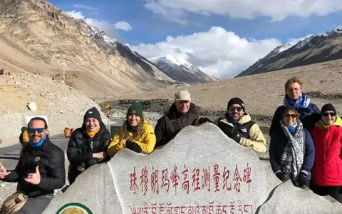
From the Tingri corridor, the road turns south toward Gawula and the Rongbuk valley. The Tibet Everest Base Camp map locates the visitor area and its facilities. After the visit, an onward journey can connect west toward Gyirong instead of returning to Lhasa.
This is worthwhile when Everest is a priority, but it adds mountain-road travel and, in some programmes, a much higher overnight. Sunset or sunrise remains weather dependent. An EBC night should never be treated as a necessary step in reaching Nepal.
Without the Everest branch
The route stays with the westbound corridor, then turns toward Gyirong. You keep the highland-to-valley descent while avoiding the drive into the Rongbuk area.
Skipping Everest does not automatically save a whole day. A long Shigatse-to-Gyirong transfer may reduce the number of nights, whereas breaking in the Tingri area gives the road more breathing room. The time saved can also allow a monastery visit or a less hurried arrival, rather than more driving.
How many road days should you allow?
CHIBET’s published seven-day Lhasa to Kathmandu overland tour includes arrival and two sightseeing days in Lhasa before the road journey. It provides a useful example of the route’s shape, not proof that a listed border departure can operate today.
The four road days below illustrate its Everest-inclusive pattern. An extra night can spread the longer transfers or change the altitude progression. The Tibet operating partner must confirm the actual itinerary and the separate Nepal transfer.
| Road day / section | Approx. km | Driving only* | Overnight | Sleeping altitude | Border step |
|---|---|---|---|---|---|
| 1: Lhasa via Yamdrok and Gyantse to Shigatse | 350–370 | 7–8 hr | Shigatse | About 3,840 m | None |
| 2: Shigatse via Tingri and Gawula to Rongbuk/EBC visitor area | 340–370 | 7–8 hr | Everest area | About 5,000–5,200 m | Internal document checks; no international exit |
| 3: Everest area to Gyirong Town, western road connection | 370–400 | 7–9 hr | Gyirong Town | About 2,700–2,800 m | Prepare for next-day crossing |
| 4: Gyirong Town to port, then Rasuwagadhi to Kathmandu | About 25, then 150–170 | About 1 hr, then 7–9 hr | Kathmandu, if transfer completes | About 1,400 m | China exit, Nepal entry, vehicle handover |
*Driving allowances exclude sightseeing, meals, immigration queues and unplanned delays. Published tour hours sometimes bundle stops into a daily estimate, so a full sightseeing day can run longer. The final day’s figures describe normal-road planning, not the damaged corridor’s present journey time. Town-to-port mileage depends on hotel and processing locations; confirm both endpoints rather than relying on a package’s rounded transfer distance.
Without EBC, a more measured alternative is Shigatse to the Shegar/New Tingri area, roughly 240–260 km and 4–5 driving hours, followed by roughly 300–340 km and 6–7 hours toward Gyirong Town. This still uses four road days after leaving Lhasa, but avoids the Everest overnight. Combining those middle legs creates a substantially longer single driving day.
The altitude changes before the border does
Lhasa is around 3,650 metres and Shigatse around 3,840 metres. The road crosses higher ground between towns; a mountain pass’s elevation is different from the height at which you spend the night.
An Everest-area overnight can raise sleeping altitude by more than 1,000 metres from Shigatse. A published seven-day schedule is not a medical recommendation.CDC altitude guidance stresses gradual increases in sleeping height. Extra nights, a lower overnight location or a different plan may be appropriate; symptoms require assessment rather than pressing on to keep a border booking.
The descent toward Nepal is also easy to misread. Gyirong County’s administrative centre, Dzongka/Zongga, is around 4,200 metres. Gyirong Town is much lower, around 2,700–2,800 metres, with the port farther down the valley. The regional tourism authority distinguishes these places. A hotel labelled simply “Gyirong” needs a more precise location.
The reverse journey climbs from Nepal toward Tibet. It needs a different altitude plan from the descending route described here.
Gyirong border route map: how the handover works
When ordinary crossings are authorised, the day begins with a drive from Gyirong Town to the assigned Chinese-side processing area. The guide coordinates the Tibet-side arrangements; you complete exit checks with your passport and required documents.
The next stage is the authorised connection to Nepal’s immigration processing. Its location and the walking or vehicle arrangements need confirmation after reconstruction. An old instruction to “walk across the bridge” is not enough to organise a future crossing.
Nepal entry follows Chinese exit. Visa-on-arrival eligibility depends on nationality and the operating entry point; a Chinese visa does not cover Nepal. The Nepal Tourism Board’s visa guidance explains the distinction between arrival visas and visas obtained beforehand. Confirm the applicable rule before leaving Lhasa.
The Nepal-side driver should have your names, contact details and an agreed meeting place. Keep the contact available offline and establish who helps move the luggage. Ordinary tour arrangements should not assume that the Tibet vehicle or guide continues into Nepal.
Rasuwagadhi to Kathmandu is still a mountain-road journey
Under normal conditions, the Nepal-side transfer is roughly 150–170 kilometres, commonly needing most of a driving day. The selected road through the Rasuwa–Trishuli corridor, traffic and Kathmandu drop-off point all affect the total.
That distance can look short beside the plateau days. Winding roads, narrow sections and possible landslide delays make the comparison misleading. Finishing immigration late can push arrival into the evening; a blocked road can change the overnight plan entirely.
A next-day international flight leaves little room for border or road disruption. A flexible Kathmandu stay is more practical than treating the border transfer as a timed airport connection. Your booking should identify whether the Nepal vehicle, hotel drop-off and contingency accommodation are included.
Is the Friendship Highway open for your travel dates?
Last checked: 26 October 2026. Normal tourist crossing through Gyirong–Rasuwagadhi has not been confirmed restored following the 26 August disaster. Do not book an onward connection on the assumption that the full overland journey is available.
China’s 2 September rescue update concerns access for rescue work. It does not announce normal international passenger operations. The U.S. State Department’s Nepal advisory, checked for this article, advises against travel to the affected Rasuwagadhi–Timure–Syafrubesi area, including the crossing.
Before a through route can be sold as executable, both sides need to confirm ordinary passenger processing, the connecting roads and the transfer arrangements. Cargo movement or an exceptional evacuation does not establish access for a new tourist group.
If the border is unavailable: return to Lhasa and fly
For fixed Nepal dates, compare a Tibet round trip ending back in Lhasa with a separately confirmed flight to Kathmandu. From the Everest region, that normally means returning through Shigatse and allowing two substantial road stages to Lhasa before the flight. A flight from Lhasa should not be attached to the end of an Everest transfer on the same day.
The Kathmandu to Lhasa map places the air gateway alongside the road corridor; for travel in this direction, check a dated Lhasa-to-Kathmandu departure. Himalaya Airlines advertises the Lhasa-Kathmandu connection, but its published network does not confirm seats or operation on your date. If a nonstop flight is unavailable, any connection through mainland China needs its own schedule and entry checks.
Ask for a revised proposal covering the extra Tibet nights, road transport, flight fare, Nepal pickup and treatment of unused border services. Keep a flexible night before a separately ticketed onward departure. This is an alternative to price and confirm, not an automatic free replacement for an overland booking.
Zhangmu or another port is not an automatic substitute. The Tibet Nepal map places the different gateways in context, but actual entry permission must be confirmed separately. Flight-network information last checked: 26 October 2026; dated availability must be reconfirmed.
Conclusion
Choose the Everest branch for the mountain visit, not because it is required for Nepal. Then plan the overnight sequence and the cross-border handover as carefully as the sightseeing.
Tell CHIBET your dates, group size and whether Everest is a priority through our contact us page. Ask for the return-to-Lhasa-and-fly option alongside any overland proposal that can be confirmed for your dates, with the different costs and endpoints made clear. The licensed operating partners confirm the arrangements on their respective sides.
Frequently Asked Questions
FAQ
Can I join a group in Lhasa and finish in Kathmandu?
Yes, that is a common overland tour format when crossing conditions allow. Check the contractual endpoint: some packages finish at the Chinese border, with Nepal transport charged separately. A tour’s title alone does not establish a Kathmandu hotel drop-off.
Does a China visa cover entry into Nepal?
No. Nepal has its own entry requirements. Your passport determines whether you need a visa in advance, qualify for an arrival visa, or fall under another arrangement. A Tibet permit is not a Nepal entry document either.
Can I take a rental car across the border?
An ordinary rental agreement does not authorise international vehicle entry. A self-drive crossing would require separate vehicle, customs and travel approvals. For a guided overland tour, plan on the specifically arranged vehicles on each side.
What should my booking say if the border closes?
It should explain who decides on a reroute and how additional driving, flights, accommodation and cancellations are charged. Ask which unused services are refundable and what your insurer covers. There is no universal promise that a closure triggers a free flight or a full refund.