Tibet does not have a single travel season. In the same week, the forested valleys in the southeast can be wet and green while the western plateau stays dry and cold, and a valley town can be mild while a pass two hours away is under snow. This map sets the months against the destinations and routes that suit them. It sits inside our wider Tibet map hub, which links every map page on the site.
Quick Tibet Seasonal Travel Map Facts
Seasonal windows, month-by-month conditions and access notes on this page are long-term patterns compiled in October 2026, not a forecast; road, pass, border and permit status are separate questions that must be checked close to departure with a licensed operator.
Tibet Seasonal Travel Map: The Year at a Glance
Tibet is wide enough that its seasons overlap instead of following one another. The monsoon reaches the southeast first and weakens as it moves northwest, and altitude does the rest, so the same month means different things in a lower valley town and on the northern lakes. That is why there is no single best time to visit Tibet — only good months for particular places. What follows are long-term climate patterns rather than a forecast, and daily weather, road and pass conditions, and border-area access are separate questions that no season answers for you.
If you already know your travel month, jump to the month-by-month section. If you are choosing a month first, the map below is the place to start.
Tibet Travel Seasons at a Glance
A rough map of the travel year, before the destinations are added.
| Period | Typical conditions | Main travel focus |
|---|---|---|
| Jan–Feb | Cold, dry winter | Lhasa and cultural travel |
| Mar–Apr | Spring transition | Nyingchi, Lhasa, selected southern routes |
| May–Jun | High-altitude travel expands | Everest, Kailash, Namtso |
| Jul–Aug | Summer, more rain in some regions | Lhasa, Nyingchi, lakes, long routes |
| Sep–Oct | Autumn, often clearer mountain views | Everest, Kailash, Nyingchi |
| Nov–Dec | Winter transition and cold | Lhasa and lower-route travel |
Typical long-term conditions rather than a forecast for your dates.

Seasonal Windows for the Main Tibet Destinations
| Destination | Typical seasonal window | Main reason to go | Main seasonal consideration |
|---|---|---|---|
| Lhasa | Year-round | Culture and heritage | Winter cold, summer rain |
| Nyingchi | Spring, summer and autumn | Blossom, forest and valley scenery | Rain and cloud cover |
| Everest | Spring and autumn | Himalayan views | Cloud, wind and cold |
| Kailash | Late spring to early autumn | Kora and pilgrimage | Snow and high passes |
| Namtso | Warmer months | Lake and plateau scenery | High altitude and road conditions |
Seasonal windows and current access checked October 2026; conditions can shift inside the same season.

Tibet Travel by Month: Where to Go and What to Expect
Planning Tibet by month is really a route question, and there is no single best season to hang the answer on. Each month below covers the destinations that work, what conditions are like on the ground, and the planning point that decides the trip. Two months can look similar in Lhasa and completely different four hours west, so read these against your route rather than against the calendar.
January: Lhasa and Winter Tibet
Lhasa is quiet in January. Days are cold, dry and bright, mornings and nights stay below freezing, and the queues at the Potala Palace and the Jokhang belong to a different month. Add the Barkhor for the circuit of stalls and pilgrims, and Drepung and Sera for the two large monastery campuses outside the city.
This is a month for the city rather than the plateau. A Lhasa-centred itinerary is easy to arrange, and so is a short loop into a lower valley. Anything above 4,500 m deserves a proper look at road and pass conditions first, and the long western drives are better left for another trip. Winter narrows Tibet; it does not close it.
February: Lhasa and Tibetan New Year
February keeps January’s weather and adds one variable: Losar, Tibetan New Year. Depending on the year it falls in February or in a neighbouring month, and when it does land here the Barkhor and the Jokhang area fill with families in new clothes while hotels and tickets become harder to pin down at short notice.
If the festival is what brings you here, build the plan around Lhasa and confirm the dates before booking anything. Outside the city the conditions are much the same as January, and the passes are still in deep winter.
March: Nyingchi Begins to Turn Green
Spring arrives in the southeast while the rest of the plateau is still in winter. Nyingchi’s valleys sit lower than Lhasa and catch moisture from the southeast, so they warm and green up weeks earlier, and peach blossom opens across parts of the region from mid-to-late March into April. The timing moves with valley and elevation from one year to the next; county blossom forecasts in recent years have put the window between mid-March and mid-April.
A Nyingchi-and-Lhasa combination is the natural March itinerary, and the drive between them crosses the Mila Pass. Everything above 4,000 m is still winter, so keep Nyingchi’s spring where it belongs: it tells you nothing about conditions at Everest or in the west.
April: Nyingchi, Lhasa and the Start of the Main Season
April is the month the map opens up. Blossom is finishing in the lowest valleys but the forested road east is worth a full day, Lhasa turns mild, and the road south past Yamdrok Lake, at about 4,441 m, becomes more practical again, although the high passes can still be cold. Shigatse, at about 3,840 m, is easy to add, and the Everest corridor starts to become workable. Spring departures of our Tibet peach blossom tour run the Nyingchi valleys, Lhasa and Yamdrok.
The high ground is not ready. Cold air still sits on the passes between Tingri and Everest Base Camp, and the far west is at least a month away from its window. April itineraries that stay in the eastern valleys and central Tibet are the ones that fit the season.
May: Everest, Kailash and the Long Western Routes
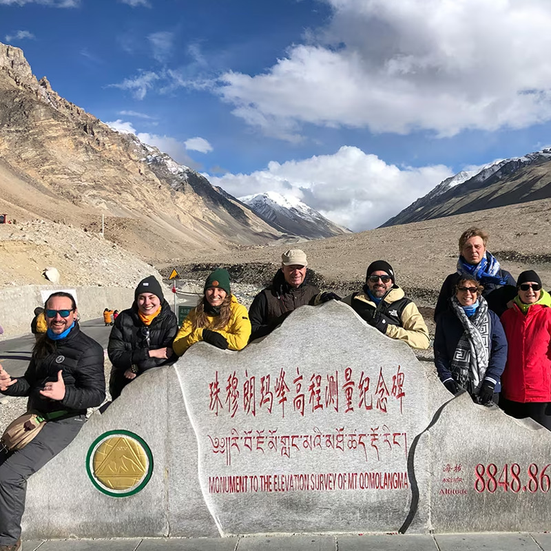
May is when the high-altitude season opens properly. The Everest corridor comes into its window, and the long western route through Saga to Darchen generally enters its main travel window, which puts the Kailash kora in reach — many itineraries run roughly from May to early October, subject to current access and road conditions. Days are longer and the passes are less likely to hold fresh snow. For the route itself, see our Lhasa to Everest Base Camp map.
Temperature is a poor guide at this height. The north-side base camp sits at about 5,200 m and Rongbuk Monastery below it at about 4,980 m, and a warm afternoon in Lhasa tells you nothing about the wind at either. Nights on the western plateau stay cold well into June, so pack for where you are going rather than for Lhasa.
June: High-Altitude Lakes and Western Tibet
June is often the quiet sweet spot of the year. The lakes are open: Namtso, at about 4,718 m on the northern plateau, is reached over the Nagen La at about 5,190 m, and the western routes to Kailash and Manasarovar are inside their usual travel window. Rain has not settled in across the plateau yet. For the lake landscape itself, our Tibet lakes map places Namtso and Yamdrok in context.
It does by the end of the month. Moisture arrives from the southeast first, so the eastern valleys cloud over earlier than the west, and afternoon build-up can hide peaks on a day that started clear. Long driving days are worth a buffer from here on.
July: Summer Landscapes and the Monsoon Effect
July is the height of the growing season and the hardest month to plan for views. The monsoon reaches Tibet in these weeks: rain and cloud across the southern and eastern ranges, fuller valleys almost everywhere, and green climbing slopes that were brown in spring. Lhasa, Nyingchi and the eastern forest road are a pleasure in themselves.
Visibility is the trade-off. Summer weather is not uniform across the plateau — the far west stays drier than the southeast — but on the Everest corridor cloud can close the mountain for days. Build flexibility into the schedule instead of betting on one clear morning.
August: Green Valleys, Lakes and Cultural Travel
August is still firmly in the summer pattern, but by now route choice matters more than the calendar. The green valleys, the lakes and the monasteries all hold up well — Namtso, Yamdrok, Lhasa and Nyingchi remain useful options — while the long mountain routes need more flexibility around rain and cloud than they did in June.
Mountain visibility changes sharply from one day to the next, so treat Everest and Kailash as options rather than promises, and check current access before committing. Rain also affects mountain roads. A seasonal pattern is a starting point, not a road-opening calendar.
September: Everest, Kailash and Clearer Autumn Skies
September usually brings the change that people plan a year ahead for. The monsoon thins, the air clears and clearer Himalayan views become more common again. The western plateau is still inside its travel window, so Everest and Kailash can sit in the same trip, with Namtso and Shigatse fitted around them.
That does not make every September day clear. Cloud still builds in the afternoon, and the first snow of the season can reach a pass above 5,000 m. For the kora itself, our guide to the best time to visit Kailash and Manasarovar sets out what each month means for the mountain.
October: Everest Views and Autumn Landscapes
October is the month many travellers ask for, and the reasons are real: clear air, settled roads and a plateau turned gold in the valleys. It is also the month of the National Day holiday, from October 1 to 7, when domestic travel surges and hotels, tickets and transport tighten across the region.
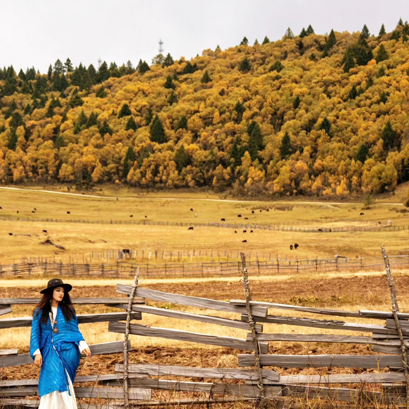
Outside the holiday peak, visitor pressure generally eases. Autumn colour lasts longest in the east, around Nyingchi and the forested valleys, while the clearest mountain views belong to the south and west. It is not automatically the right month for everyone, but it is the strongest one for travellers whose priority is landscape and mountain visibility. Our autumn Nyingchi itinerary covers the forest and glacier valleys in this window.
November: Lhasa and the Drift into Winter
November is a transition. High-altitude roads become more weather-sensitive, and the passes can take snow at any time. Days shorten and the light goes early, which matters on long driving days.
From here a Lhasa-centred itinerary becomes the safe default again, with central Tibet and the lower valleys as easy additions. Longer western drives are still possible but need a current check before you commit, and the ground above 5,000 m needs a specific reason and a current check of its own.
December: Winter Lhasa and Lower Routes
December is cold, dry and bright, with the same hard frost at the start and end of the day that January brings and the same absence of crowds. Lhasa, the monasteries and the lower valleys work well, and the winter ice season in the eastern glaciers begins around this time. Our winter Nyingchi glacier itinerary runs that route on December departures.
Two things are worth knowing about the plateau in winter. Namtso is not closed: the scenic area switches to winter operating hours, and the frozen lake is promoted as a winter sight, though access depends on road conditions and the ice itself is scenery rather than a place to walk. Everest is a different proposition again, with the seasonal tent camps at base camp closed and high-altitude lodging in the Rongbuk area limited.
Tibet’s Seasons Side by Side
Read month by month, the seasonal map is a long list. Read by season, it becomes four choices, and most trips come down to picking one. The table below compresses the year into the trade-offs that actually decide a Tibet itinerary: what each season opens, what it closes, and which route it suits best.
| Season | Months | What it opens | What it closes | Best-fit route |
|---|---|---|---|---|
| Winter | December–February | Quiet Lhasa, the central valleys, the eastern glacier ice season | Namtso access, the long western drives, the Kailash kora | Lhasa and the lower central loop |
| Spring | March–May | Nyingchi peach blossom, the first clear Everest views, rising temperatures | Nothing fully, but strong winds and some high passes stay uncertain | Nyingchi, then the Everest corridor |
| Summer | June–August | The high lakes, the western plateau behind the rain shadow, green valleys | Clear summit views in the south and east, which the monsoon clouds often hide | High lakes and western routes |
| Autumn | September–November | The broadest window: clear Everest and Kailash views, stable roads, good light | Little — the main constraint is demand and the first winter snows late in the season | Everest, Kailash and the classic loop |
Why Autumn Is the Safest Single Choice
If you have one trip and one window, autumn is the least risky season on the map. The monsoon has cleared from the southern mountains, so Everest and the Kailash kora are usually at their most visible; the roads are stable after the summer rains and before the winter snows; and the light is clear across both the valleys and the plateau. The trade-off is demand: September and October are when the best itineraries and lodges fill first, so autumn rewards booking early rather than booking late.

How the Seasons Line Up on the Map
Season and altitude interact, and the map shows it clearly. Lhasa at about 3,650 m is workable almost all year, which is why the capital anchors the winter trips. Nyingchi in the lower southeast runs on a milder clock again, warm and green earlier than the plateau. The high country — the Everest region, the western lakes and the Kailash approach — has the narrowest window of all, because it is the altitude, not the latitude, that sets its season. The practical rule is that the higher a route sits on the map, the shorter its usable season, so plan the high routes around their window and fill the rest of the trip with the lower ones.

Weather, Roads and Seasonal Route Planning
A season describes what a route is normally like. It cannot tell you what a road is doing today, which is why the weather map below and the notes that follow keep the two apart.

Summer Rain and Mountain Roads
Rain in the southern and eastern mountains affects roads in ways no season can predict. A slope stable for months can come down after a week of heavy rain, and the eastern approach roads, cut into steep valley sides, are the most exposed.
The point is not that July means closed roads. It is that summer rain raises the chance of delays, and the road you need may be affected while the next valley over is fine. Recent disruptions make the same case at the borders: a crossing can be affected by an event at any time of year, regardless of its normal seasonal window, which is why seasonal planning never replaces a current check.
Winter Snow and High Passes
Snow reaches the high passes first and leaves them last. Every crossing above 5,000 m can be temporarily closed or controlled after a snowfall: Nagen La on the way to Namtso, the passes on the western road, the crossings on the Everest corridor. These closures are usually short and usually unpredictable.
Lhasa’s own weather tells you very little about any of them. The city can be dry and sunny while the pass out of the valley is impassable, so winter planning on this plateau is about pass information rather than about temperature.
Weather and Mountain Visibility Are Not the Same Thing
Clear weather does not guarantee a view of Everest. Cloud around the high peaks moves within hours, and a fine morning at base camp can end with the mountain behind a bank of cumulus. Summer gives green valleys and more cloud, autumn tends to give thinner air and longer sightlines, and neither is a promise.
For the peaks, the useful question is not whether the weather is good but how long you are there. Two nights in the same place give you several chances; a single afternoon gives you one.
Why Seasonal Patterns Cannot Confirm Current Road Conditions
A seasonal pattern describes what usually happens. It says nothing about the state of a road, a border crossing or a permit on the day you travel. A seasonal map is not a permission map, and a good month is not an open road.
Current road, border and permit requirements are confirmed separately, close to departure, with your operator. Rail timetables for reaching Lhasa are published on the China Railway 12306 English site. Our Tibet travel permit guide covers the document side, our Tibet road map shows which corridors the seasonal notes above apply to, and the foreign traveller page tracks changes to access by date.
Choosing a Route by Travel Month
This table is the shortest version of the page: six planning periods, the routes that fit each of them, and the point that decides the trip.
| Travel period | Routes to consider | Main planning point |
|---|---|---|
| Jan–Feb | Lhasa-centred travel | Cold-winter conditions on everything else |
| Mar–Apr | Lhasa and Nyingchi | Spring scenery, cold passes |
| May–Jun | Everest, Kailash and the lakes | High-altitude travel window |
| Jul–Aug | Lhasa, Nyingchi, the lakes, long routes | Rain, cloud and schedule flexibility |
| Sep–Oct | Everest, Kailash and Nyingchi | Mountain visibility and autumn colour |
| Nov–Dec | Lhasa-centred travel | Winter transition and high-pass risk |
None of these periods is empty. Every month can support a workable trip; what changes is where that trip goes. Map boundaries and place-name drawing are checked against China’s official standard maps published by the Ministry of Natural Resources standard map service.
Frequently Asked Questions
Tibet Seasonal Travel Map FAQ
Is Tibet a year-round destination?
Lhasa and the central valleys are broadly year-round, and a winter trip to the city works well. The high-altitude and remote routes are more seasonal: Everest, Kailash, Namtso and the long western drives have windows of a few months rather than a full year. Choosing a route matters more here than an open-or-closed idea of the region. The Tibet travel route map shows which routes carry which seasonal constraints.
What is the best time to visit Everest in Tibet?
There is no single month. Three things decide the trip: whether the mountain is visible, how much cloud and precipitation the season brings, and how cold the road and lodging are. Spring and autumn are the periods many travellers plan around — spring with more wind, autumn with clearer air — but the conditions for your exact dates still need confirming. The Lhasa to Everest Base Camp map lays out the corridor that these conditions affect.
When can I visit Mount Kailash?
Many itineraries run roughly from May to early October, subject to current access conditions. The seasonal constraints are the high pass on the kora and the long western road that gets you there, both of which are sensitive to snow. Pilgrimage demand can also shape which dates are practical, so confirm the road and permit situation for your dates before booking. The Mount Kailash map and the best time to visit Kailash guide go deeper on the western window.
When is Nyingchi best for peach blossoms?
The blossom usually opens from mid-to-late March into April, varying by valley and by elevation, and county forecasts in recent years have put the window between mid-March and mid-April. It shifts from one year to the next, so treat any single date you see quoted as an estimate rather than a promise. The Tibet lakes map places the eastern valleys against the plateau’s other lakes.
How should I choose a Tibet route by month?
Work backwards from your travel month rather than forwards from a wish-list destination. Winter (roughly November to February) belongs to Lhasa and the lower central valleys; spring (March to May) opens Nyingchi for blossom and Everest for the first clear views; summer (June to August) favours the high lakes and the western routes while the southern valleys meet the monsoon; autumn (September to November) is the broadest window, with Everest and Kailash at their clearest. Pick the month first, then read the map for what that month actually allows.
Does the monsoon really affect a Tibet trip?
Less than it affects Nepal, but it does matter. From roughly July to August the southern and eastern mountains catch more cloud and rain, which can hide summits and occasionally disrupt high mountain roads, while the western plateau often stays drier behind the Himalaya rain shadow. The effect is regional rather than uniform, which is why the same month can be poor on one route and fine on another. The Tibet road map shows where the rain-sensitive mountain sections sit.
Is winter a bad time to visit Tibet?
Not for Lhasa. The capital in winter is cold but often bright and quiet, with thinner crowds and lower prices, and the central valleys are travelable. What winter closes is the high and remote country: the pass roads towards Namtso, the long western drives and the Kailash kora are the seasonal casualties. So the answer depends on the route, not the season: winter is a good time for the city and a poor time for the high west.
Can I rely on seasonal patterns to know if a road is open?
No. Seasonal patterns describe what is typical, not what is true on your dates. A pass that usually opens in May can still be blocked by a late snow, and a summer road can be cut by a landslide regardless of the season. Treat the seasonal map as a planning filter to choose when and where, then confirm current road and border status close to departure through your operator.
Where do these seasonal dates and figures come from?
Seasonal windows, month-by-month descriptions and access notes on this page are long-term climate patterns and route practice compiled in October 2026, and they are not a weather forecast. The National Day holiday runs from October 1 to 7, when demand tightens across the region; the Kailash window is given as roughly May to early October, subject to current access. Road, pass, border and permit status change independently of the season and are confirmed close to departure through your operator.